
Fort Smith topographic map
Click on the map to display elevation.
About this map
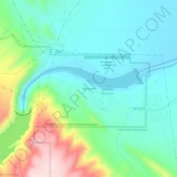
Name: Fort Smith topographic map, elevation, terrain.
Location: Fort Smith, Big Horn County, Montana, 59035, United States (45.29274 -107.95706 45.33274 -107.91706)
Average elevation: 3,474 ft
Minimum elevation: 3,159 ft
Maximum elevation: 4,337 ft
Big Horn County trails, hiking, mountain biking, running and outdoor activities
Other topographic maps
Click on a map to view its topography, its elevation and its terrain.