
Gumba topographic map
Interactive map
Click on the map to display elevation.
About this map
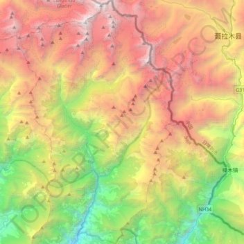
Name: Gumba topographic map, elevation, terrain.
Location: Gumba, Jugal, Sindhupalchowk, Bagmati Pradesh, Nepal (27.89923 85.74384 28.20255 85.90275)
Average elevation: 12,375 ft
Minimum elevation: 3,747 ft
Maximum elevation: 22,835 ft
Other topographic maps
Click on a map to view its topography, its elevation and its terrain.
Tatopani
Nepal > Sindhupalchowk > Tatopani
Tatopani, Bhotekoshi, Sindhupalchowk, Bagmati Pradesh, Nepal
Average elevation: 10,466 ft
Bahrabise
Nepal > Sindhupalchowk > Bahrabise
Bahrabise, Barhabise, Sindhupalchowk, Bagmati Pradesh, Nepal
Average elevation: 4,383 ft