
Thank you for supporting this site ❤️
Make a donation
Make a donation
Gear up for your next adventure:
As an Amazon Associate, this site earns from qualifying purchases at no extra cost to you.
Juam-myeon topographic map
Click on the map to display elevation.
Thank you for supporting this site ❤️
Make a donation
Make a donation
Gear up for your next adventure:
As an Amazon Associate, this site earns from qualifying purchases at no extra cost to you.
About this map
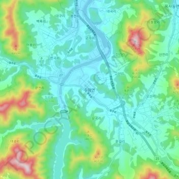
Name: Juam-myeon topographic map, elevation, terrain.
Location: Juam-myeon, Suncheon-si, South Jeolla, 57910, South Korea (35.03374 127.21237 35.11374 127.29237)
Average elevation: 571 ft
Minimum elevation: 180 ft
Maximum elevation: 1,831 ft
Thank you for supporting this site ❤️
Make a donation
Make a donation
Gear up for your next adventure:
As an Amazon Associate, this site earns from qualifying purchases at no extra cost to you.
Other topographic maps
Click on a map to view its topography, its elevation and its terrain.