
Kalama topographic map
Click on the map to display elevation.
About this map
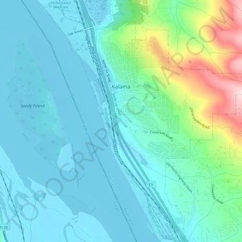
Name: Kalama topographic map, elevation, terrain.
Location: Kalama, Cowlitz County, Washington, United States (45.98303 -122.86131 46.02239 -122.80276)
Average elevation: 190 ft
Minimum elevation: -7 ft
Maximum elevation: 988 ft
Cowlitz County trails, hiking, mountain biking, running and outdoor activities
Other topographic maps
Click on a map to view its topography, its elevation and its terrain.
Toutle River Sediment Retention Structure
United States > Washington > Cowlitz County
Average elevation: 1,138 ft
Toutle River Sediment Retention Structure
United States > Washington > Cowlitz County
Average elevation: 1,138 ft