
Thank you for supporting this site ❤️
Make a donation
Make a donation
Gear up for your next adventure:
As an Amazon Associate, this site earns from qualifying purchases at no extra cost to you.
A Veiga topographic map
Click on the map to display elevation.
Thank you for supporting this site ❤️
Make a donation
Make a donation
Gear up for your next adventure:
As an Amazon Associate, this site earns from qualifying purchases at no extra cost to you.
About this map
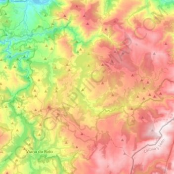
Name: A Veiga topographic map, elevation, terrain.
Location: A Veiga, Valdeorras, Ourense, Galice, Espagne (42.17226 -7.10605 42.36345 -6.78714)
Average elevation: 3,337 ft
Minimum elevation: 945 ft
Maximum elevation: 5,771 ft
Thank you for supporting this site ❤️
Make a donation
Make a donation
Gear up for your next adventure:
As an Amazon Associate, this site earns from qualifying purchases at no extra cost to you.