
Thank you for supporting this site ❤️
Make a donation
Make a donation
Gear up for your next adventure:
As an Amazon Associate, this site earns from qualifying purchases at no extra cost to you.
Monesma topographic map
Click on the map to display elevation.
Thank you for supporting this site ❤️
Make a donation
Make a donation
Gear up for your next adventure:
As an Amazon Associate, this site earns from qualifying purchases at no extra cost to you.
About this map
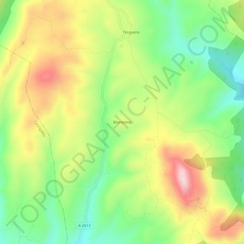
Name: Monesma topographic map, elevation, terrain.
Location: Monesma, Monesma y Cajigar, La Ribagorza, Huesca, Aragón, España (42.20609 0.59048 42.24609 0.63048)
Average elevation: 3,304 ft
Minimum elevation: 2,740 ft
Maximum elevation: 4,032 ft
Thank you for supporting this site ❤️
Make a donation
Make a donation
Gear up for your next adventure:
As an Amazon Associate, this site earns from qualifying purchases at no extra cost to you.