
Thank you for supporting this site ❤️
Make a donation
Make a donation
Gear up for your next adventure:
As an Amazon Associate, this site earns from qualifying purchases at no extra cost to you.
Nazca topographic map
Click on the map to display elevation.
Thank you for supporting this site ❤️
Make a donation
Make a donation
Gear up for your next adventure:
As an Amazon Associate, this site earns from qualifying purchases at no extra cost to you.
About this map
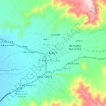
Name: Nazca topographic map, elevation, terrain.
Location: Nazca, Province of Nasca, Ica, 11401, Peru (-14.86772 -74.97706 -14.78772 -74.89706)
Average elevation: 2,267 ft
Minimum elevation: 1,693 ft
Maximum elevation: 4,052 ft
Thank you for supporting this site ❤️
Make a donation
Make a donation
Gear up for your next adventure:
As an Amazon Associate, this site earns from qualifying purchases at no extra cost to you.