
Thank you for supporting this site ❤️
Make a donation
Make a donation
Gear up for your next adventure:
As an Amazon Associate, this site earns from qualifying purchases at no extra cost to you.
Karaca topographic map
Click on the map to display elevation.
Thank you for supporting this site ❤️
Make a donation
Make a donation
Gear up for your next adventure:
As an Amazon Associate, this site earns from qualifying purchases at no extra cost to you.
About this map
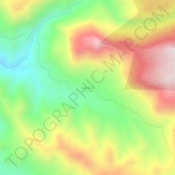
Name: Karaca topographic map, elevation, terrain.
Location: Karaca, Şirvan, Siirt, Southeastern Anatolia Region, Turkey (38.10146 42.01417 38.14146 42.05417)
Average elevation: 3,950 ft
Minimum elevation: 2,510 ft
Maximum elevation: 5,653 ft
Thank you for supporting this site ❤️
Make a donation
Make a donation
Gear up for your next adventure:
As an Amazon Associate, this site earns from qualifying purchases at no extra cost to you.