
Thank you for supporting this site ❤️
Make a donation
Make a donation
Gear up for your next adventure:
As an Amazon Associate, this site earns from qualifying purchases at no extra cost to you.
Barrancos topographic map
Click on the map to display elevation.
Thank you for supporting this site ❤️
Make a donation
Make a donation
Gear up for your next adventure:
As an Amazon Associate, this site earns from qualifying purchases at no extra cost to you.
About this map
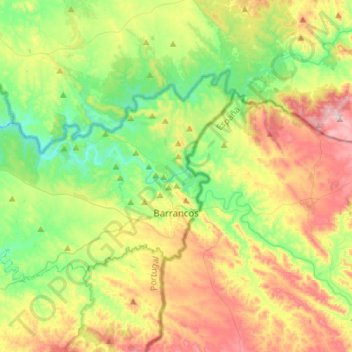
Name: Barrancos topographic map, elevation, terrain.
Location: Barrancos, Beja, Baixo Alentejo, Alentejo, 7230-030, Portugal (38.08852 -7.21075 38.22066 -6.93150)
Average elevation: 1,010 ft
Minimum elevation: 463 ft
Maximum elevation: 1,903 ft
Thank you for supporting this site ❤️
Make a donation
Make a donation
Gear up for your next adventure:
As an Amazon Associate, this site earns from qualifying purchases at no extra cost to you.