
向化藏族乡 topographic map
Interactive map
Click on the map to display elevation.
About this map
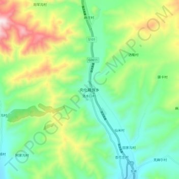
Name: 向化藏族乡 topographic map, elevation, terrain.
Location: 向化藏族乡, 大通回族土族自治县, 西宁市, 青海省, 中国 (37.05235 101.75769 37.13235 101.83769)
Average elevation: 9,715 ft
Minimum elevation: 8,868 ft
Maximum elevation: 11,480 ft
Other topographic maps
Click on a map to view its topography, its elevation and its terrain.