
Make a donation
Gear up for your next adventure:
As an Amazon Associate, this site earns from qualifying purchases at no extra cost to you.
Nicaragua topographic map
Click on the map to display elevation.
Make a donation
Gear up for your next adventure:
As an Amazon Associate, this site earns from qualifying purchases at no extra cost to you.
About this map
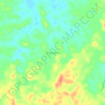
Name: Nicaragua topographic map, elevation, terrain.
Location: Nicaragua, Bajo Cauca, Antioquia, Colombia (7.66470 -75.42835 7.70470 -75.38835)
Average elevation: 354 ft
Minimum elevation: 279 ft
Maximum elevation: 469 ft
Make a donation
Gear up for your next adventure:
As an Amazon Associate, this site earns from qualifying purchases at no extra cost to you.
Other topographic maps
Click on a map to view its topography, its elevation and its terrain.
Medellín
Medellín has 16 comunas (districts), 5 corregimientos (townships), and 271 barrios (neighborhoods). The metropolitan area of Medellín lies within the Aburrá valley at an elevation of 1,500 meters (4,900 feet) above sea level and is bisected by the Medellín River (also called Porce), which flows northward.…
Average elevation: 6,175 ft
Comuna 13 - San Javier
Colombia > Antioquia > Medellín
Comuna 13's geography has played a role in how criminal actors took advantage of the commune as a strategic location, using elevation to better survey the movement of police and rival groups. The elevation additionally played a historical role, as Comuna 13 began as a farming community.
Average elevation: 5,620 ft
Make a donation
Gear up for your next adventure:
As an Amazon Associate, this site earns from qualifying purchases at no extra cost to you.
Santo Domingo
Santo Domingo is a town and municipality in the Colombian department of Antioquia. Part of the subregion of Northeastern Antioquia, it lies at an altitude of 1,975 m (6,480 ft) above sea level.
Average elevation: 5,384 ft
Make a donation
Gear up for your next adventure:
As an Amazon Associate, this site earns from qualifying purchases at no extra cost to you.
Gómez Plata
Gómez Plata has a cool tropical rainforest climate (Af) due to altitude. It has very heavy rainfall year round.
Average elevation: 5,394 ft
Make a donation
Gear up for your next adventure:
As an Amazon Associate, this site earns from qualifying purchases at no extra cost to you.
Make a donation
Gear up for your next adventure:
As an Amazon Associate, this site earns from qualifying purchases at no extra cost to you.
Make a donation
Gear up for your next adventure:
As an Amazon Associate, this site earns from qualifying purchases at no extra cost to you.
Make a donation
Gear up for your next adventure:
As an Amazon Associate, this site earns from qualifying purchases at no extra cost to you.
Make a donation
Gear up for your next adventure:
As an Amazon Associate, this site earns from qualifying purchases at no extra cost to you.