Geolocate

Lisec topographic map

Click on the map to display elevation.

About this map

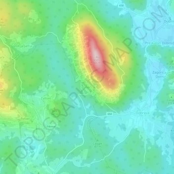
Name: Lisec topographic map, elevation, terrain.

Location: Lisec, Trebnje, 8360, Slovenia (45.84124 14.93031 45.88124 14.97031)

Average elevation: 1,017 ft

Minimum elevation: 755 ft

Maximum elevation: 1,801 ft

Gear up for your next adventure:

Backpacking Tents - Weight-optimized shelters for multi-day topographic surveys
🗃️Trail First Aid Kit - Essential kit for outdoor injuries and emergencies
🕶️GPS Smartphone Mount - Secure mount for phone navigation
🔊Portable Camp Speaker - Music and alerts at camp
🏔️Mountain Trail Maps - High‑detail maps for popular peaks

As an Amazon Associate, this site earns from qualifying purchases at no extra cost to you.