
Crail topographic map
Click on the map to display elevation.
About this map
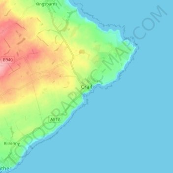
Name: Crail topographic map, elevation, terrain.
Location: Crail, Fife, Scotland, KY10 3UG, United Kingdom (56.22068 -2.66671 56.30068 -2.58671)
Average elevation: 69 ft
Minimum elevation: 0 ft
Maximum elevation: 328 ft
Other topographic maps
Click on a map to view its topography, its elevation and its terrain.