
Raymondville topographic map
Click on the map to display elevation.
About this map
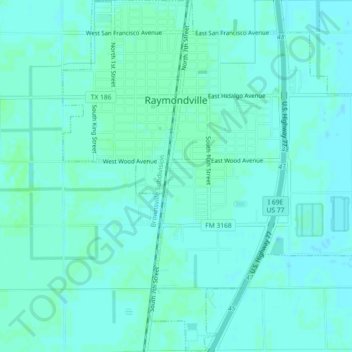
Name: Raymondville topographic map, elevation, terrain.
Location: Raymondville, Willacy County, Texas, United States (26.45230 -97.79775 26.49299 -97.75638)
Average elevation: 39 ft
Minimum elevation: 30 ft
Maximum elevation: 46 ft
Willacy County trails, hiking, mountain biking, running and outdoor activities
Other topographic maps
Click on a map to view its topography, its elevation and its terrain.