Geolocate

Manimala River topographic map

Click on the map to display elevation.

About this map

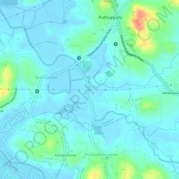
Name: Manimala River topographic map, elevation, terrain.

Location: Manimala River, Eravinalloor, Kottayam, Kerala, India (9.54319 76.56199 9.55365 76.57553)

Average elevation: 39 ft

Minimum elevation: -13 ft

Maximum elevation: 203 ft

Gear up for your next adventure:

🪶Compact Camp Shovel - Folding shovel for campsite tasks
🧥Waterproof Jacket for Hiking - Breathable and rugged rain jacket for outdoor excursions
🕶️Glacier Sunglasses - Side shields to protect eyes from high-altitude snow glare
🎒Waterproof Dry Bags - Keep your electronics and maps dry inside your pack
🔭Telescopic Hiking Pole - Adjustable pole for hiking stability

As an Amazon Associate, this site earns from qualifying purchases at no extra cost to you.