
Thank you for supporting this site ❤️
Make a donation
Make a donation
Gear up for your next adventure:
As an Amazon Associate, this site earns from qualifying purchases at no extra cost to you.
Rancheria topographic map
Click on the map to display elevation.
Thank you for supporting this site ❤️
Make a donation
Make a donation
Gear up for your next adventure:
As an Amazon Associate, this site earns from qualifying purchases at no extra cost to you.
About this map
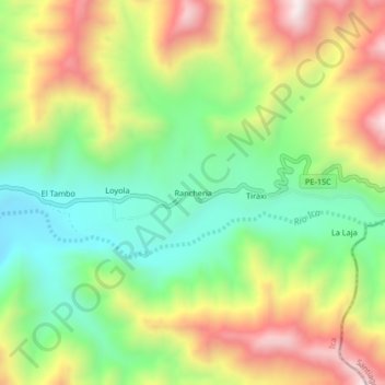
Name: Rancheria topographic map, elevation, terrain.
Location: Rancheria, San José de los Molinos, Ica, Perú (-13.85756 -75.60183 -13.81756 -75.56183)
Average elevation: 3,615 ft
Minimum elevation: 2,579 ft
Maximum elevation: 5,016 ft
Thank you for supporting this site ❤️
Make a donation
Make a donation
Gear up for your next adventure:
As an Amazon Associate, this site earns from qualifying purchases at no extra cost to you.