
Thank you for supporting this site ❤️
Make a donation
Make a donation
Gear up for your next adventure:
As an Amazon Associate, this site earns from qualifying purchases at no extra cost to you.
Lagoa topographic map
Click on the map to display elevation.
Thank you for supporting this site ❤️
Make a donation
Make a donation
Gear up for your next adventure:
As an Amazon Associate, this site earns from qualifying purchases at no extra cost to you.
About this map
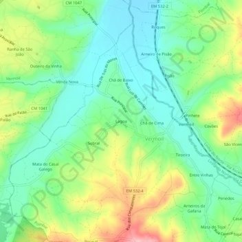
Name: Lagoa topographic map, elevation, terrain.
Location: Lagoa, Vermoil, Pombal, Leiria, 3105-363, Portugal (39.83057 -8.68631 39.87057 -8.64631)
Average elevation: 479 ft
Minimum elevation: 292 ft
Maximum elevation: 827 ft
Thank you for supporting this site ❤️
Make a donation
Make a donation
Gear up for your next adventure:
As an Amazon Associate, this site earns from qualifying purchases at no extra cost to you.