
Muskoday First Nation topographic map
Interactive map
Click on the map to display elevation.
About this map
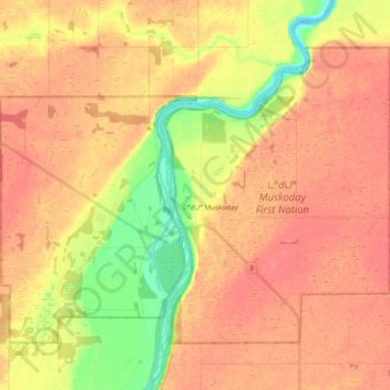
Name: Muskoday First Nation topographic map, elevation, terrain.
Average elevation: 1,467 ft
Minimum elevation: 1,348 ft
Maximum elevation: 1,529 ft
Other topographic maps
Click on a map to view its topography, its elevation and its terrain.
Crossing Island
Canada > Saskatchewan > Muskoday First Nation
Crossing Island, Muskoday First Nation, Prince Albert No. 461, Saskatchewan, S6V 0A1, Canada
Average elevation: 1,539 ft