
Brey topographic map
Click on the map to display elevation.
About this map
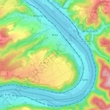
Name: Brey topographic map, elevation, terrain.
Average elevation: 486 ft
Minimum elevation: 213 ft
Maximum elevation: 1,047 ft
Other topographic maps
Click on a map to view its topography, its elevation and its terrain.
Eltz Castle
Germany > Rhineland-Palatinate > Landkreis Mayen-Koblenz > Wierschem
Average elevation: 719 ft
Miesenheim
Germany > Rhineland-Palatinate > Landkreis Mayen-Koblenz > Andernach
Average elevation: 394 ft