Geolocate

Pariwan topographic map

Click on the map to display elevation.

About this map

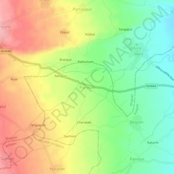
Name: Pariwan topographic map, elevation, terrain.

Location: Pariwan, Kulgam, Jammu and Kashmir, India (33.64300 74.90412 33.68300 74.94412)

Average elevation: 6,184 ft

Minimum elevation: 5,968 ft

Maximum elevation: 6,424 ft

Other topographic maps

Click on a map to view its topography, its elevation and its terrain.

Chawalgam

India > Jammu and Kashmir > Kulgam

Average elevation: 5,794 ft

Nillow

India > Jammu and Kashmir > Kulgam

Average elevation: 5,984 ft

Gear up for your next adventure:

🧺Microfiber Travel Towels - Compact and fast-drying towels for trail use
🪶Paracord Bracelet - Survival bracelet with built‑in tools
🏕️Tent Footprint - Protect your tent base from wear
🪶Multi‑Purpose Knife - Useful blade for camp and trail
🧭Outdoor Navigation Book - Learn advanced navigation skills

As an Amazon Associate, this site earns from qualifying purchases at no extra cost to you.