Geolocate

Jason topographic map

Click on the map to display elevation.

About this map

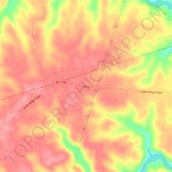
Name: Jason topographic map, elevation, terrain.

Location: Jason, Todd County, Kentucky, United States (37.02866 -87.11055 37.06866 -87.07055)

Average elevation: 666 ft

Minimum elevation: 446 ft

Maximum elevation: 748 ft

Todd County trails, hiking, mountain biking, running and outdoor activities

Gear up for your next adventure:

🔭Telescopic Hiking Pole - Adjustable pole for hiking stability
🎒Trail Energy Bars - High‑calorie bars for hiking energy
🪵Folding Camp Saw - Compact saw for wood and campsite work
🌲Outdoor Survival Books - Best books on survival skills
🔦Powerful Headlamps - Ultra-bright hands-free lighting for night navigation

As an Amazon Associate, this site earns from qualifying purchases at no extra cost to you.