

Ringgold topographic map
Click on the map to display elevation.
Ringgold
Ringgold is situated in the Valley and Ridge geologic province of the Appalachian Mountains, characterized by long north-northeasterly trending ridges separated by valleys. The topography was formed by the erosion of alternating layers of hard and soft sedimentary rock that were folded and faulted during the building of the Appalachians. Taylor Ridge runs through Ringgold; a gap in the ridge is located just east of the city center, with the part of the ridge running to the south called Taylors Ridge and to the north called White Oak Mountain. South Chickamauga Creek, a tributary of the Tennessee River, runs through Ringgold.
About this map
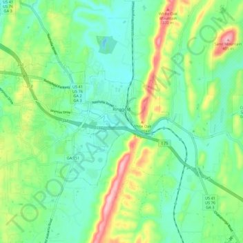
Name: Ringgold topographic map, elevation, terrain.
Location: Ringgold, Catoosa County, Georgia, United States (34.88846 -85.19659 34.93480 -85.08769)
Average elevation: 879 ft
Minimum elevation: 686 ft
Maximum elevation: 1,335 ft
Catoosa County trails, hiking, mountain biking, running and outdoor activities
Other topographic maps
Click on a map to view its topography, its elevation and its terrain.


Bark City Dog Park
United States > Georgia > Catoosa County > Fort Oglethorpe
Average elevation: 741 ft
