
Moggast topographic map
Click on the map to display elevation.
Moggast
Das Pfarrdorf liegt im südlichen Randbereich der Wiesentalb. Es befindet sich etwa fünfeinhalb Kilometer ostsüdöstlich des Ortszentrums von Ebermannstadt und liegt auf einer Höhe von 493 m ü. NHN.
About this map
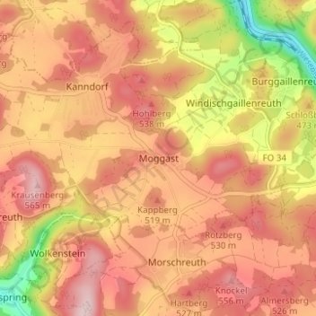
Name: Moggast topographic map, elevation, terrain.
Average elevation: 1,552 ft
Minimum elevation: 1,010 ft
Maximum elevation: 1,867 ft