
Thank you for supporting this site ❤️
Make a donation
Make a donation
Gear up for your next adventure:
As an Amazon Associate, this site earns from qualifying purchases at no extra cost to you.
Ipyeong-ri topographic map
Click on the map to display elevation.
Thank you for supporting this site ❤️
Make a donation
Make a donation
Gear up for your next adventure:
As an Amazon Associate, this site earns from qualifying purchases at no extra cost to you.
About this map
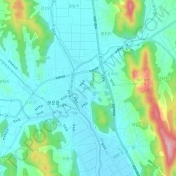
Name: Ipyeong-ri topographic map, elevation, terrain.
Location: Ipyeong-ri, Boeun-gun, North Chungcheong, 28940, South Korea (36.46660 127.70694 36.50660 127.74694)
Average elevation: 614 ft
Minimum elevation: 472 ft
Maximum elevation: 1,089 ft
Thank you for supporting this site ❤️
Make a donation
Make a donation
Gear up for your next adventure:
As an Amazon Associate, this site earns from qualifying purchases at no extra cost to you.