
Thank you for supporting this site ❤️
Make a donation
Make a donation
Gear up for your next adventure:
As an Amazon Associate, this site earns from qualifying purchases at no extra cost to you.
Felberg topographic map
Click on the map to display elevation.
Thank you for supporting this site ❤️
Make a donation
Make a donation
Gear up for your next adventure:
As an Amazon Associate, this site earns from qualifying purchases at no extra cost to you.
About this map
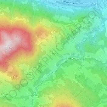
Name: Felberg topographic map, elevation, terrain.
Location: Felberg, Sankt Lambrecht, Bezirk Murau, Styrie, 8813, Autriche (47.08904 14.31175 47.12904 14.35175)
Average elevation: 3,461 ft
Minimum elevation: 2,428 ft
Maximum elevation: 5,190 ft
Thank you for supporting this site ❤️
Make a donation
Make a donation
Gear up for your next adventure:
As an Amazon Associate, this site earns from qualifying purchases at no extra cost to you.