
Thank you for supporting this site ❤️
Make a donation
Make a donation
Gear up for your next adventure:
As an Amazon Associate, this site earns from qualifying purchases at no extra cost to you.
Kadid Ra`aynah topographic map
Click on the map to display elevation.
Thank you for supporting this site ❤️
Make a donation
Make a donation
Gear up for your next adventure:
As an Amazon Associate, this site earns from qualifying purchases at no extra cost to you.
About this map
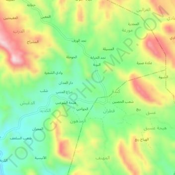
Name: Kadid Ra`aynah topographic map, elevation, terrain.
Location: Kadid Ra`aynah, Sharab ar Rawnah, Ta'izz, Jemen (13.70318 43.87547 13.74318 43.91547)
Average elevation: 3,927 ft
Minimum elevation: 3,366 ft
Maximum elevation: 4,701 ft
Thank you for supporting this site ❤️
Make a donation
Make a donation
Gear up for your next adventure:
As an Amazon Associate, this site earns from qualifying purchases at no extra cost to you.