
Thank you for supporting this site ❤️
Make a donation
Make a donation
Gear up for your next adventure:
As an Amazon Associate, this site earns from qualifying purchases at no extra cost to you.
Chuquirahua topographic map
Click on the map to display elevation.
Thank you for supporting this site ❤️
Make a donation
Make a donation
Gear up for your next adventure:
As an Amazon Associate, this site earns from qualifying purchases at no extra cost to you.
About this map
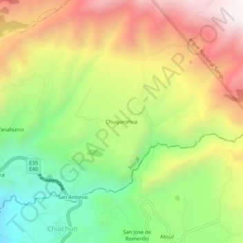
Name: Chuquirahua topographic map, elevation, terrain.
Location: Chuquirahua, Juncal, Cañar, 030360, Ecuador (-2.49405 -78.96257 -2.45405 -78.92257)
Average elevation: 10,774 ft
Minimum elevation: 8,963 ft
Maximum elevation: 12,808 ft
Thank you for supporting this site ❤️
Make a donation
Make a donation
Gear up for your next adventure:
As an Amazon Associate, this site earns from qualifying purchases at no extra cost to you.