Geolocate

Farmington topographic map

Click on the map to display elevation.

About this map

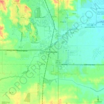
Name: Farmington topographic map, elevation, terrain.

Location: Farmington, Dakota County, Minnesota, 55024, United States (44.60024 -93.18355 44.68024 -93.10355)

Average elevation: 919 ft

Minimum elevation: 866 ft

Maximum elevation: 1,027 ft

Dakota County trails, hiking, mountain biking, running and outdoor activities

Gear up for your next adventure:

🏕️Tent Footprint - Protect your tent base from wear
🪶Wildlife Field Guides - Learn animal tracking and species ID
🧦Hiking Socks - Comfortable socks to prevent blisters on long hikes
📌Outdoor GPS Map App - Apps and devices for digital topographic navigation
🌲Outdoor Survival Books - Best books on survival skills

As an Amazon Associate, this site earns from qualifying purchases at no extra cost to you.