Geolocate

Mapleton topographic map

Click on the map to display elevation.

About this map

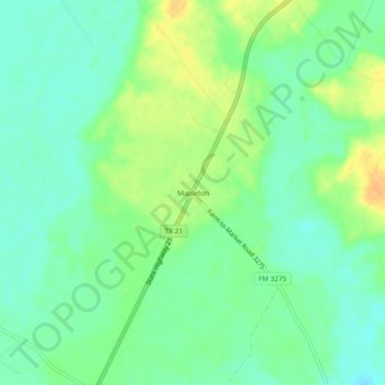
Name: Mapleton topographic map, elevation, terrain.

Location: Mapleton, Houston County, Texas, United States (31.12018 -95.68884 31.16018 -95.64884)

Average elevation: 184 ft

Minimum elevation: 144 ft

Maximum elevation: 243 ft

Houston County trails, hiking, mountain biking, running and outdoor activities

Gear up for your next adventure:

🧢Sun Protection Hats - Wide-brimmed and UPF-rated hats for high-altitude sun safety
🪵Folding Camp Saw - Compact saw for wood and campsite work
🎒Trekking Poles - Sturdy poles for balance and stability on rough terrain
🪑Ultralight Camp Chairs - Portable seating for resting after a long day of mapping
🧷Carabiner Set - Durable clips for gear attachment

As an Amazon Associate, this site earns from qualifying purchases at no extra cost to you.