Geolocate

Milan topographic map

Click on the map to display elevation.

About this map

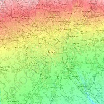
Name: Milan topographic map, elevation, terrain.

Location: Milan, Lombardy, 20122, Italy (45.30419 9.02963 45.62419 9.34963)

Average elevation: 427 ft

Minimum elevation: 220 ft

Maximum elevation: 738 ft

Gear up for your next adventure:

🦶Hiking Gaiters - Keep debris and water out of your boots
🏕️Family Camping Gear - Essentials for group camping trips
🎒Outdoor Daypacks - Lightweight backpacks designed for carrying maps and essential gear
📚USA Hiking Guide Books - Top trail guides and map books
🛶Inflatable Kayak - Portable kayak for rivers, lakes, and expeditions

As an Amazon Associate, this site earns from qualifying purchases at no extra cost to you.