
Thank you for supporting this site ❤️
Make a donation
Make a donation
Gear up for your next adventure:
As an Amazon Associate, this site earns from qualifying purchases at no extra cost to you.
Manouba topographic map
Click on the map to display elevation.
Thank you for supporting this site ❤️
Make a donation
Make a donation
Gear up for your next adventure:
As an Amazon Associate, this site earns from qualifying purchases at no extra cost to you.
About this map
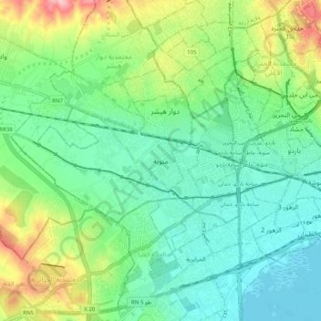
Name: Manouba topographic map, elevation, terrain.
Location: Manouba, منوبة, معتمدية منوبة, Manouba, 2051, Tunisia (36.77133 10.05470 36.85133 10.13470)
Average elevation: 174 ft
Minimum elevation: 10 ft
Maximum elevation: 574 ft
Thank you for supporting this site ❤️
Make a donation
Make a donation
Gear up for your next adventure:
As an Amazon Associate, this site earns from qualifying purchases at no extra cost to you.