
Sytomino topographic map
Interactive map
Click on the map to display elevation.
About this map
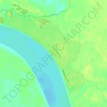
Name: Sytomino topographic map, elevation, terrain.
Average elevation: 102 ft
Minimum elevation: 72 ft
Maximum elevation: 128 ft
Other topographic maps
Click on a map to view its topography, its elevation and its terrain.
Русскинская
Russia > Khanty-Mansiysk Autonomous Okrug – Ugra > Surgutsky District
Русскинская, сельское поселение Русскинская, Surgutsky District, Khanty-Mansiysk Autonomous Okrug – Ugra, Ural Federal District, Russia
Average elevation: 207 ft