
Dr. Phillips topographic map
Interactive map
Click on the map to display elevation.
About this map
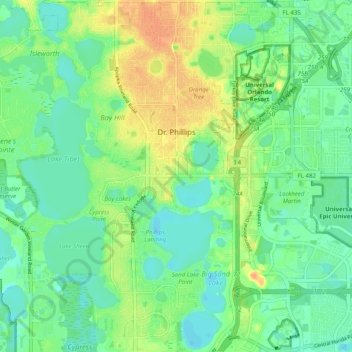
Name: Dr. Phillips topographic map, elevation, terrain.
Location: Dr. Phillips, Orange County, Florida, United States (28.40595 -81.52344 28.49371 -81.47461)
Average elevation: 112 ft
Minimum elevation: 69 ft
Maximum elevation: 184 ft
Orange County trails, hiking, mountain biking, running and outdoor activities
Other topographic maps
Click on a map to view its topography, its elevation and its terrain.
Harlem Heights
United States > Florida > Orange County > Winter Garden > Harlem Heights
Average elevation: 118 ft