
Thank you for supporting this site ❤️
Make a donation
Make a donation
Gear up for your next adventure:
As an Amazon Associate, this site earns from qualifying purchases at no extra cost to you.
Wittnau topographic map
Click on the map to display elevation.
Thank you for supporting this site ❤️
Make a donation
Make a donation
Gear up for your next adventure:
As an Amazon Associate, this site earns from qualifying purchases at no extra cost to you.
About this map
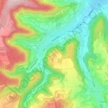
Name: Wittnau topographic map, elevation, terrain.
Location: Wittnau, Bezirk Laufenburg, Aargau, 5064, Switzerland (47.45479 7.94003 47.49407 7.99632)
Average elevation: 1,709 ft
Minimum elevation: 1,224 ft
Maximum elevation: 2,375 ft
Thank you for supporting this site ❤️
Make a donation
Make a donation
Gear up for your next adventure:
As an Amazon Associate, this site earns from qualifying purchases at no extra cost to you.