
Thank you for supporting this site ❤️
Make a donation
Make a donation
Gear up for your next adventure:
As an Amazon Associate, this site earns from qualifying purchases at no extra cost to you.
Konnur topographic map
Click on the map to display elevation.
Thank you for supporting this site ❤️
Make a donation
Make a donation
Gear up for your next adventure:
As an Amazon Associate, this site earns from qualifying purchases at no extra cost to you.
About this map
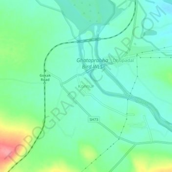
Name: Konnur topographic map, elevation, terrain.
Location: Konnur, Gokak taluku, Belgaum district, Karnataka, India (16.18177 74.72898 16.22177 74.76898)
Average elevation: 2,041 ft
Minimum elevation: 1,959 ft
Maximum elevation: 2,254 ft
Thank you for supporting this site ❤️
Make a donation
Make a donation
Gear up for your next adventure:
As an Amazon Associate, this site earns from qualifying purchases at no extra cost to you.