Geolocate

Togdheer topographic map

Click on the map to display elevation.

About this map

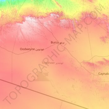
Name: Togdheer topographic map, elevation, terrain.

Location: Togdheer, Burao District, Togdheer, Somaliland, Somalia (8.30149 44.48500 10.30149 46.48500)

Average elevation: 3,051 ft

Minimum elevation: 292 ft

Maximum elevation: 6,532 ft

Gear up for your next adventure:

🕶️Glacier Sunglasses - Side shields to protect eyes from high-altitude snow glare
🧭Orienteering Set - Complete compass and map reading kit
Backpacking Tents - Weight-optimized shelters for multi-day topographic surveys
🎁Geography Themed Gifts - Unique gift ideas for map lovers and geography enthusiasts
🌡️Portable Weather Meter - Track weather conditions on the trail

As an Amazon Associate, this site earns from qualifying purchases at no extra cost to you.