
Thank you for supporting this site ❤️
Make a donation
Make a donation
Gear up for your next adventure:
As an Amazon Associate, this site earns from qualifying purchases at no extra cost to you.
Hazlehurst topographic map
Click on the map to display elevation.
Thank you for supporting this site ❤️
Make a donation
Make a donation
Gear up for your next adventure:
As an Amazon Associate, this site earns from qualifying purchases at no extra cost to you.
About this map
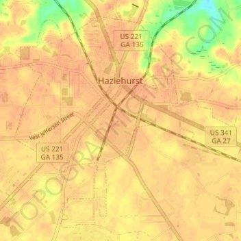
Name: Hazlehurst topographic map, elevation, terrain.
Location: Hazlehurst, Jeff Davis County, Georgia, United States (31.83831 -82.62083 31.88341 -82.56033)
Average elevation: 249 ft
Minimum elevation: 154 ft
Maximum elevation: 276 ft
Jeff Davis County trails, hiking, mountain biking, running and outdoor activities
Thank you for supporting this site ❤️
Make a donation
Make a donation
Gear up for your next adventure:
As an Amazon Associate, this site earns from qualifying purchases at no extra cost to you.