
Thank you for supporting this site ❤️
Make a donation
Make a donation
Gear up for your next adventure:
As an Amazon Associate, this site earns from qualifying purchases at no extra cost to you.
Penafiel topographic map
Click on the map to display elevation.
Thank you for supporting this site ❤️
Make a donation
Make a donation
Gear up for your next adventure:
As an Amazon Associate, this site earns from qualifying purchases at no extra cost to you.
About this map
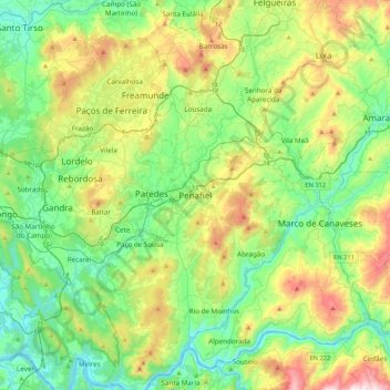
Name: Penafiel topographic map, elevation, terrain.
Location: Penafiel, Porto, Norte, 4560-491, Portugal (41.04619 -8.44557 41.36619 -8.12557)
Average elevation: 853 ft
Minimum elevation: 20 ft
Maximum elevation: 2,822 ft
Thank you for supporting this site ❤️
Make a donation
Make a donation
Gear up for your next adventure:
As an Amazon Associate, this site earns from qualifying purchases at no extra cost to you.