
Thank you for supporting this site ❤️
Make a donation
Make a donation
Gear up for your next adventure:
As an Amazon Associate, this site earns from qualifying purchases at no extra cost to you.
Bishing topographic map
Click on the map to display elevation.
Thank you for supporting this site ❤️
Make a donation
Make a donation
Gear up for your next adventure:
As an Amazon Associate, this site earns from qualifying purchases at no extra cost to you.
About this map
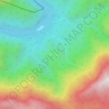
Name: Bishing topographic map, elevation, terrain.
Location: Bishing, Geling, Upper Siang, Arunachal Pradesh, India (29.09077 95.00681 29.13077 95.04681)
Average elevation: 3,747 ft
Minimum elevation: 1,683 ft
Maximum elevation: 7,438 ft
Thank you for supporting this site ❤️
Make a donation
Make a donation
Gear up for your next adventure:
As an Amazon Associate, this site earns from qualifying purchases at no extra cost to you.