Geolocate

Lee topographic map

Click on the map to display elevation.

About this map

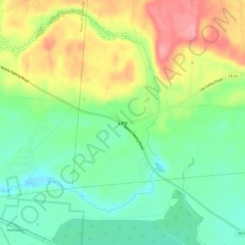
Name: Lee topographic map, elevation, terrain.

Location: Lee, Town of Lee, Oneida County, New York, United States (43.25871 -75.59186 43.29871 -75.55186)

Average elevation: 538 ft

Minimum elevation: 404 ft

Maximum elevation: 725 ft

Gear up for your next adventure:

🧺Microfiber Travel Towels - Compact and fast-drying towels for trail use
🪶Fire Starter Kit - Reliable fire starter for survival and camping
📻Weather Alert Radios - Stay informed of storm risks while off-the-grid
📷Action Camera - Capture your outdoor adventures in HD
☀️Outdoor Sunscreen - High protection sunscreen for outdoor activities

As an Amazon Associate, this site earns from qualifying purchases at no extra cost to you.