Geolocate

King George topographic map

Click on the map to display elevation.

About this map

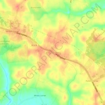
Name: King George topographic map, elevation, terrain.

Location: King George, King George County, Virginia, United States (38.24818 -77.20442 38.28818 -77.16442)

Average elevation: 154 ft

Minimum elevation: 52 ft

Maximum elevation: 217 ft

King George County trails, hiking, mountain biking, running and outdoor activities

Gear up for your next adventure:

🔦Powerful Headlamps - Ultra-bright hands-free lighting for night navigation
🕶️GPS Smartphone Mount - Secure mount for phone navigation
🕶️Glacier Sunglasses - Side shields to protect eyes from high-altitude snow glare
🪶Trail Camera - Capture wildlife on your hikes
🧦Merino Wool Socks - Moisture-wicking, blister-preventing socks for long treks

As an Amazon Associate, this site earns from qualifying purchases at no extra cost to you.