
Thank you for supporting this site ❤️
Make a donation
Make a donation
Gear up for your next adventure:
As an Amazon Associate, this site earns from qualifying purchases at no extra cost to you.
Cuena topographic map
Click on the map to display elevation.
Thank you for supporting this site ❤️
Make a donation
Make a donation
Gear up for your next adventure:
As an Amazon Associate, this site earns from qualifying purchases at no extra cost to you.
About this map
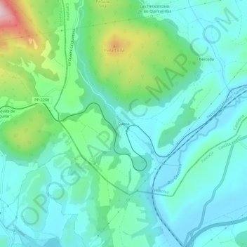
Name: Cuena topographic map, elevation, terrain.
Location: Cuena, Valdeolea, Campoo-Los Valles, Cantabria, 39418, España (42.83633 -4.23031 42.87633 -4.19031)
Average elevation: 3,192 ft
Minimum elevation: 2,969 ft
Maximum elevation: 3,953 ft
Thank you for supporting this site ❤️
Make a donation
Make a donation
Gear up for your next adventure:
As an Amazon Associate, this site earns from qualifying purchases at no extra cost to you.