Geolocate

Maple Falls topographic map

Click on the map to display elevation.

About this map

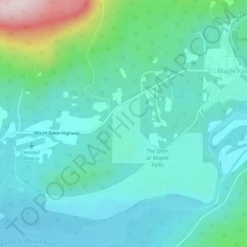
Name: Maple Falls topographic map, elevation, terrain.

Location: Maple Falls, Whatcom County, Washington, United States (48.90386 -122.11554 48.93225 -122.07183)

Average elevation: 741 ft

Minimum elevation: 436 ft

Maximum elevation: 2,034 ft

Whatcom County trails, hiking, mountain biking, running and outdoor activities

Gear up for your next adventure:

Camping Coffee Makers - Enjoy premium coffee at the summit or campsite
📻Weather Alert Radios - Stay informed of storm risks while off-the-grid
🥤Water Filter Bottle - All‑in‑one filter bottle for safe hydration
🔊Portable Camp Speaker - Music and alerts at camp
🔦LED Headlamp - Bright and durable LED headlamp for night navigation

As an Amazon Associate, this site earns from qualifying purchases at no extra cost to you.