Geolocate

Saranac topographic map

Click on the map to display elevation.

About this map
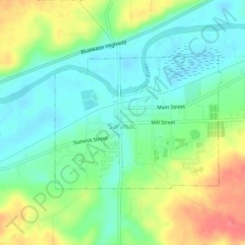
Name: Saranac topographic map, elevation, terrain.

Location: Saranac, Boston Township, Ionia County, Michigan, United States (42.92227 -85.22304 42.93695 -85.19797)

Average elevation: 689 ft

Minimum elevation: 614 ft

Maximum elevation: 814 ft

Ionia County trails, hiking, mountain biking, running and outdoor activities

Gear up for your next adventure:

🧣Hiking Neck Gaiter - Multi‑use neck protection for outdoor weather
🪶Camping Sleeping Pad - Comfortable sleeping pad for backpacking
🔦Powerful Headlamps - Ultra-bright hands-free lighting for night navigation
🧭Pro Hiking Compasses - High-accuracy liquid-filled compasses for topographic orientation
🖼️Topo Map Wall Art - Decorative topographic prints of famous peaks and regions

As an Amazon Associate, this site earns from qualifying purchases at no extra cost to you.