
Thank you for supporting this site ❤️
Make a donation
Make a donation
Gear up for your next adventure:
As an Amazon Associate, this site earns from qualifying purchases at no extra cost to you.
Sumri topographic map
Click on the map to display elevation.
Thank you for supporting this site ❤️
Make a donation
Make a donation
Gear up for your next adventure:
As an Amazon Associate, this site earns from qualifying purchases at no extra cost to you.
About this map
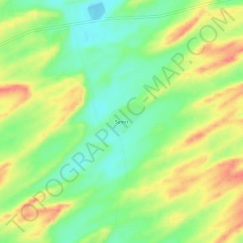
Name: Sumri topographic map, elevation, terrain.
Location: Sumri, Diplo, Tharparkar District, Sindh, 69280, Pakistan (24.43901 69.60466 24.47901 69.64466)
Average elevation: 115 ft
Minimum elevation: 10 ft
Maximum elevation: 240 ft
Thank you for supporting this site ❤️
Make a donation
Make a donation
Gear up for your next adventure:
As an Amazon Associate, this site earns from qualifying purchases at no extra cost to you.