
Eloor topographic map
Click on the map to display elevation.
About this map
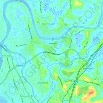
Name: Eloor topographic map, elevation, terrain.
Average elevation: 30 ft
Minimum elevation: -13 ft
Maximum elevation: 115 ft
Other topographic maps
Click on a map to view its topography, its elevation and its terrain.
Periyar River
India > Kerala > Paravur > Edayar
The southernmost part of the Cardamom Hills i.e. the source of Periyar River is a narrow valley extending south of Kumily. This is the southern extreme of the Periyar basin. It is less than 20 kilometres (12 mi) wide and is about 40 kilometres (25 mi) long. The upper catchments of Periyar extend as a wedge…
Average elevation: 26 ft