
Make a donation
Gear up for your next adventure:
As an Amazon Associate, this site earns from qualifying purchases at no extra cost to you.
Le Moule topographic map
Click on the map to display elevation.
Make a donation
Gear up for your next adventure:
As an Amazon Associate, this site earns from qualifying purchases at no extra cost to you.
Le Moule
La végétation est variée et dépend de facteurs tels que la proximité de la mer, l'exposition aux vents, l'humidité, la topographie et le type de sol. Plusieurs domaines peuvent être distingués.
Make a donation
Gear up for your next adventure:
As an Amazon Associate, this site earns from qualifying purchases at no extra cost to you.
About this map
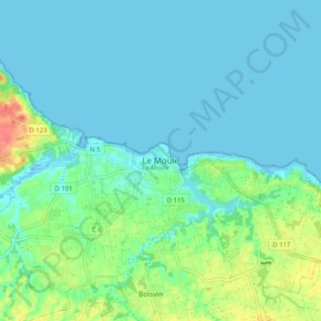
Name: Le Moule topographic map, elevation, terrain.
Location: Le Moule, Pointe-à-Pitre, Guadeloupe, 97160, France (16.29167 -61.38762 16.37167 -61.30762)
Average elevation: 39 ft
Minimum elevation: -10 ft
Maximum elevation: 187 ft
Make a donation
Gear up for your next adventure:
As an Amazon Associate, this site earns from qualifying purchases at no extra cost to you.