Geolocate

Seven Devils topographic map

Click on the map to display elevation.

About this map

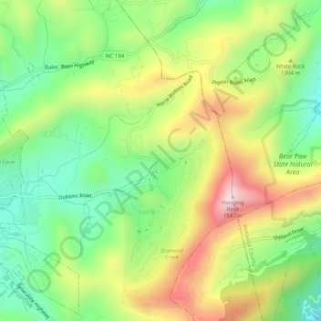
Name: Seven Devils topographic map, elevation, terrain.

Location: Seven Devils, Avery County, North Carolina, 28604, USA (36.13818 -81.85539 36.17818 -81.81539)

Average elevation: 4,137 ft

Minimum elevation: 3,445 ft

Maximum elevation: 5,108 ft

Gear up for your next adventure:

🪄Magnetic Compass - Accurate compass for navigation
🩳Quick‑Dry Hiking Shorts - Comfortable and quick‑dry shorts for summer hiking
🔦LED Headlamp - Bright and durable LED headlamp for night navigation
🛌Ultralight Sleeping Bags - Compact down bags for cold nights in the wilderness
🧤Hiking Gloves - Protective gloves for rugged trails

As an Amazon Associate, this site earns from qualifying purchases at no extra cost to you.