
Make a donation
Gear up for your next adventure:
As an Amazon Associate, this site earns from qualifying purchases at no extra cost to you.
Barito Kuala topographic map
Click on the map to display elevation.
Make a donation
Gear up for your next adventure:
As an Amazon Associate, this site earns from qualifying purchases at no extra cost to you.
About this map
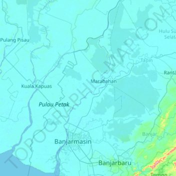
Name: Barito Kuala topographic map, elevation, terrain.
Location: Barito Kuala, South Kalimantan, 70582, Indonesia (-3.51911 114.35168 -2.52325 114.86922)
Average elevation: 33 ft
Minimum elevation: -7 ft
Maximum elevation: 1,775 ft
Make a donation
Gear up for your next adventure:
As an Amazon Associate, this site earns from qualifying purchases at no extra cost to you.
Other topographic maps
Click on a map to view its topography, its elevation and its terrain.
Sungai Banyiur Utara
Indonesia > South Kalimantan > Barito Kuala > Pulau Sewangi
Average elevation: 10 ft
Make a donation
Gear up for your next adventure:
As an Amazon Associate, this site earns from qualifying purchases at no extra cost to you.