
Thank you for supporting this site ❤️
Make a donation
Make a donation
Gear up for your next adventure:
As an Amazon Associate, this site earns from qualifying purchases at no extra cost to you.
Bêche topographic map
Click on the map to display elevation.
Thank you for supporting this site ❤️
Make a donation
Make a donation
Gear up for your next adventure:
As an Amazon Associate, this site earns from qualifying purchases at no extra cost to you.
About this map
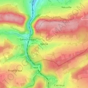
Name: Bêche topographic map, elevation, terrain.
Location: Bêche, Vielsalm, Bastenaken, Luxemburg, Wallonië, 6671, België (50.24340 5.89753 50.28340 5.93753)
Average elevation: 1,509 ft
Minimum elevation: 1,155 ft
Maximum elevation: 1,778 ft
Thank you for supporting this site ❤️
Make a donation
Make a donation
Gear up for your next adventure:
As an Amazon Associate, this site earns from qualifying purchases at no extra cost to you.